
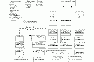
![Modellierung von Koordinaten-Referenz-Systemen - Hauptkonzept [Voser 2007]](http://mapmaking.mapref.org/wp-content/uploads/2018/11/crs-change-a-300x261.gif)
Modellierung von Koordinaten-Referenz-Systemen – Hauptkonzept [Voser 2007]
Konzeptuelle Modellierung von Koordinatensystemen für Geodateninfrastrukturen
[Voser 2007]
(“Conceptual Modelling of Coordinate Systems for Geodatainfrastructures”)
in german
2007, ca. 240 Pages A4, softcover, 68 graphics, 79 tables;
including:
- Introduction to Geodatainfrastructure, Georeferencing etc.
- Coordinate Systems and Metrics
- Earth Models and Related Reference Systems
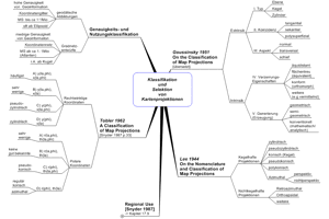
- Map Projections (Systematics of Projections and a new Systematics of Projection Parameters)
- Changing between Coordinate Reference Systems
- Interoparability Aspects, Standardization – ISO, OGC
- Aspects of Geodatamanagement and Softwarerequirements
- A New Conceptual Model of CRS and relationships, described in UML
Selected Topics from Voser 2007:


Add a Comment